
2013 Research Season
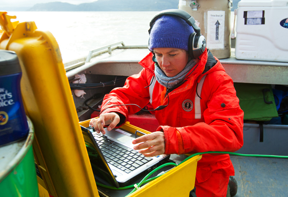
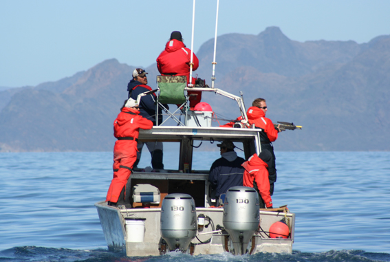
Field researchers, working with Inuit from Mittimatalik (Pond Inlet, NU), have been able to attach 5 satellite tags to killer whales. This information will help understand where killer whales are moving and how they may be affecting the other whales and seals in the high Arctic.
The map below shows where these whales are (red dots) and where they have been (red arrow lines). Some of the locations may be on land but this is due to poor satellite data not because the animals were actually on land.
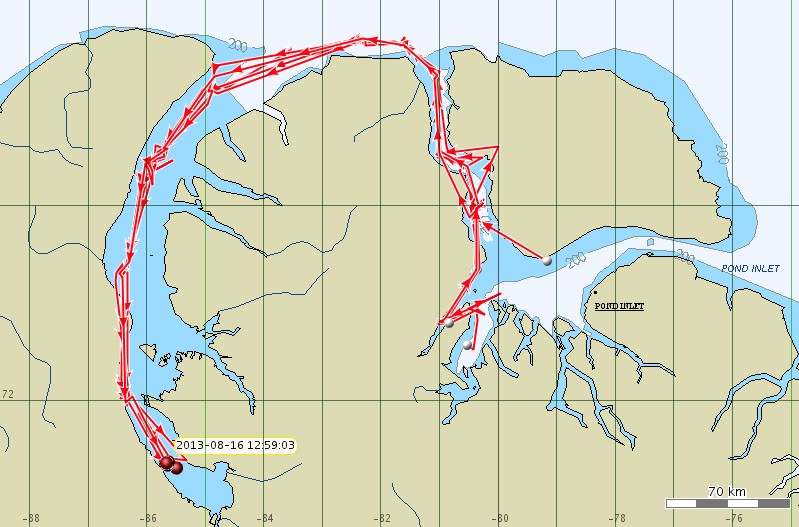
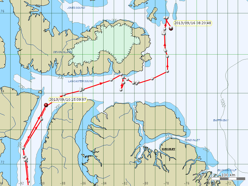
Tagged Killer Whale movements in 2013, to Aug. 16.
(Click map for larger version.)
August 16 Update: Killer Whale movements in August.
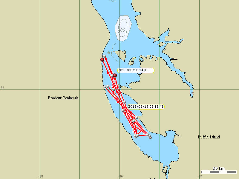
Tagged killer whale movements in the southern portion
of Admiralty Inlet, Nunavut from Aug 16-19.
(Click map for larger version.)
August 19 Update: Killer Whale movements in Admiralty Inlet.
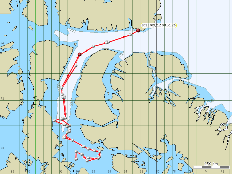
This map shows the last 10 days of killer
whale movements (to Sept. 12, 2013).
(Click map for larger version.)
Sept. 12 Update: We are down to 2 tags (the red dots) from the 5 tags that were deployed. This is because the tags are designed to fall off the animals. We hoped that they would last as long as the battery life (~3 months) but this is not always the case. The ice is starting to form in the north and it looks like the killer whales are heading for the open water of the Atlantic.
The last 10 days of killer whale movements (to Sept. 16, 2013).
(Click map for larger version.)
Sept. 16 Update: We are down to a single functioning tag now.
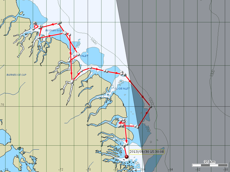
The last 10 days of movements (to Sept. 30, 2013).
(Click map for larger version. Grey shading is the sunset line.)
September 30 Update: The last 10 days of tracking data from the last remaining tag.
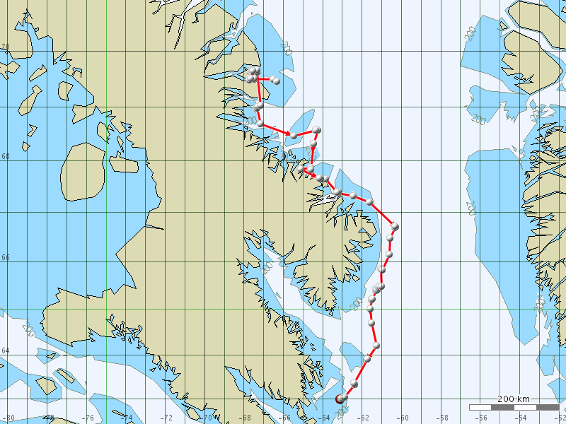
Movements to Oct. 8, 2013).
(Click map for larger version.)
October 8 Update: Killer whale movements between September 28 and October 8, 2013.
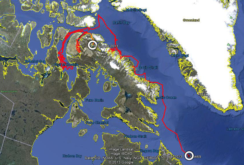
Summary of movements for 2013.
(Click map for larger version.)
Final 2013 Update: Killer whale movements from August to October.
2011 Research Season
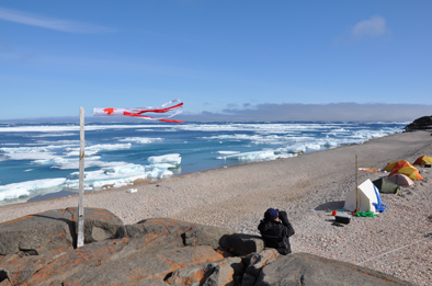
In 2011, field activities were moved to Cumberland Sound, where killer whales have been observed in recent years and to coincide with other whale research being conducted there. Unfortunately, no killer whales were reported in the Sound during field operations. 2011 was a good year for sightings and 19 observations were reported.
2010 Research Season
In August 2010, researchers returned to Admiralty Inlet to continue killer whale research initiated in 2009. The field team comprised Cory Matthews (PhD student, University of Manitoba), Stephen Petersen (Visiting Fellow, DFO), local guides and boat captains Nataq Levi and Tommy Tatatoapik (Arctic Bay, NU), and research photographer Gretchen Freund (St. Louis, Missouri). Researchers were joined by a BBC film crew consisting of Matt Swarbrick (director), Max Hug-Williams (cameraman), and local observer Randy Oyukuluk. This year the weather did not cooperate and, although we saw killer whales on one day, we were not able to tag or biopsy them. After everyone had left the camp at Kakiak Point, Gretchen returned for a couple of days and was able to photograph several whales for our photo identification program.
Camp at Kakiak Point with lots of ice
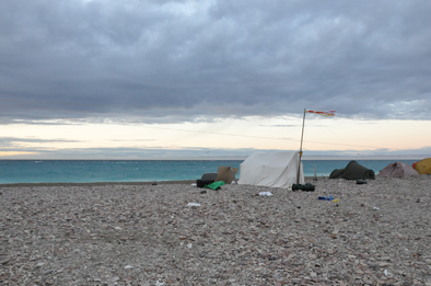
Camp at Kakiak Point with no more ice but lots of wind
2009 Research Season
This August we conducted research near the community of Arctic Bay. With the support of the Ikajutit Hunters and Trappers Association and the boating skills of our guide Nataq, we were able to accomplish all our goals for this season. The killer whale research team was able to take many photos of killer whales for photo identification, take one skin sample for genetic and chemical analysis, and place 2 satellite transmitters on individual whales for movement analysis.
The maps below show the track for the satellite tag that we were able to deploy on August 15th in Admiralty Inlet (first map). The last transmission that we have received was from November 13th near the Azores (second map). The data that we have indicate that this group has broken the previous records for killer whale speed and distance traveled. The Fall 2009 issue of the Aarluk News has a summary of this information.
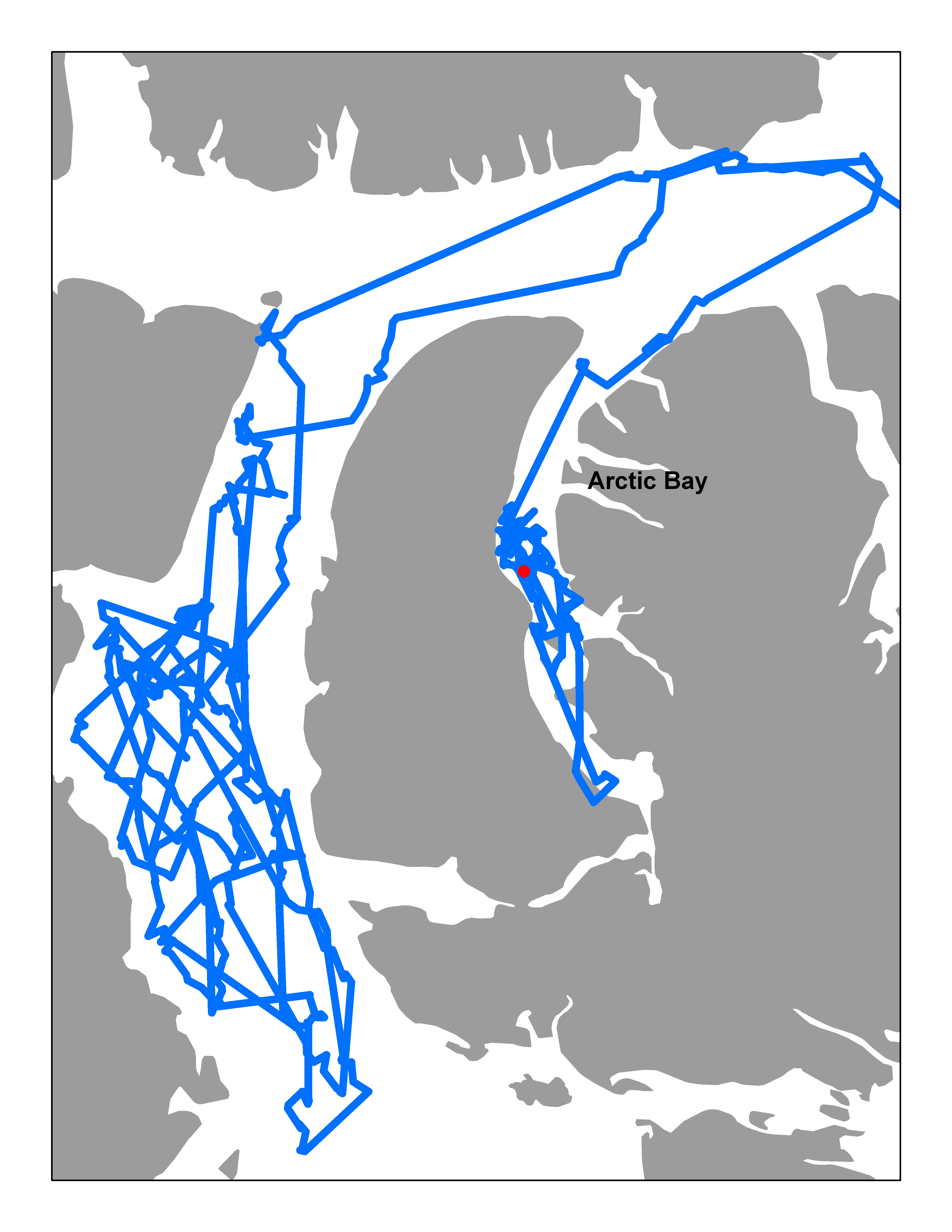
Summer movements in 2009.
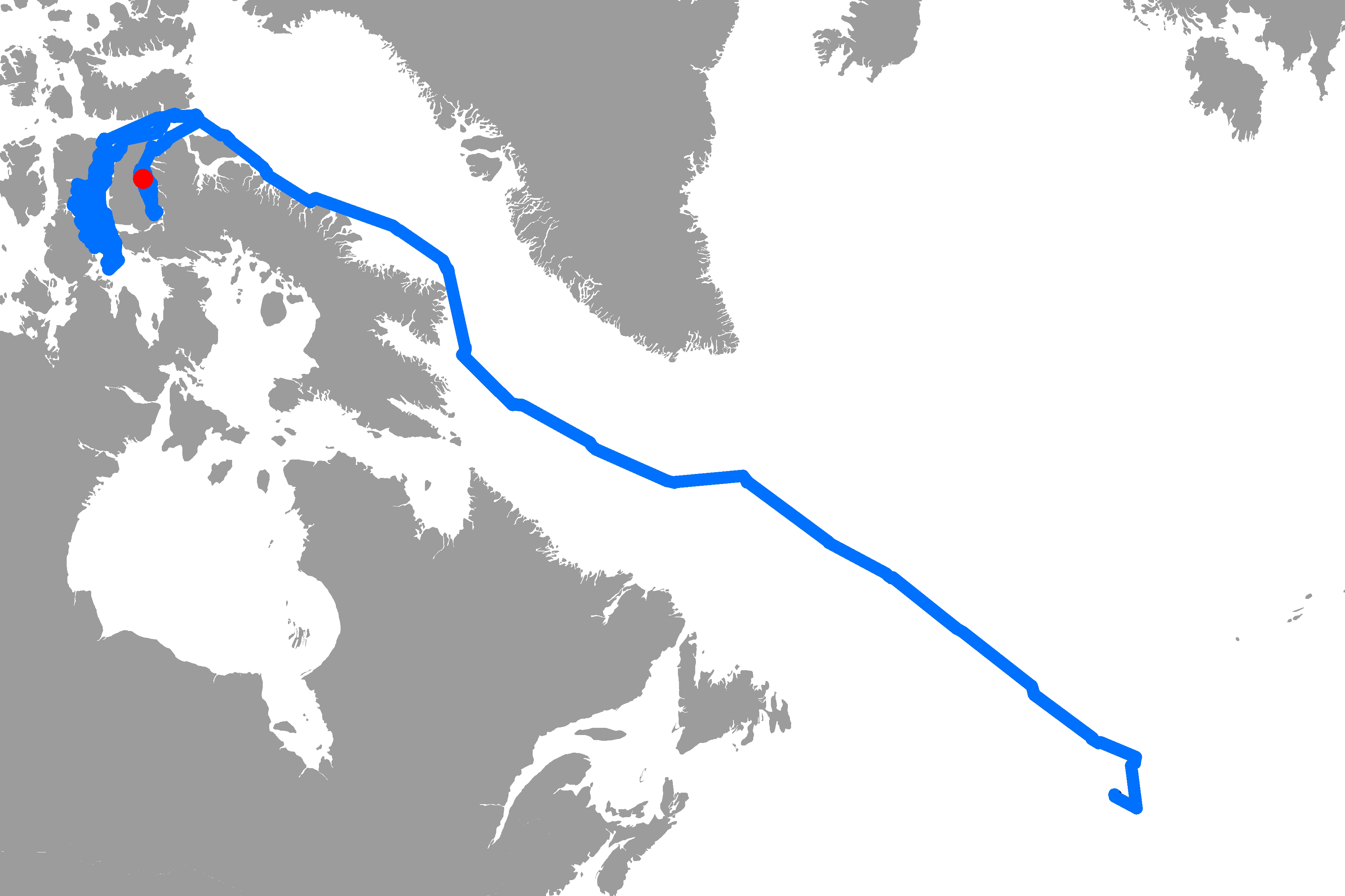
Whole track showing migration to Azores.